An Introduction to the Boreal Shield.
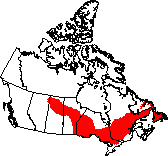
Largest of Canada's ecozones, the Boreal Shield covers a vast area from Alberta to Newfoundland, south of the Taiga Shield and Hudson Plains and north of numerous ecozones, including the Boreal Plains, Mixedwood Plains, and the Atlantic Maritime. This being said, the above mentioned ecozone is Canada's largest terrestrial ecozone, at approximately 1.8 million squared kilometers. Due to the large area the Boreal Shield covers, it is approximately 20% of Canada's land mass, and about 10% of its fresh water. Stretching 3,800 kilometers from Alberta to Newfoundland, the shield includes parts of six provinces. A small portion of Alberta is incorporated in the shield, meanwhile larger portions, such as Saskatchewan, Manitoba, Ontario, and Quebec are the main focuses of the shield. Similar to Alberta, only a portion of Newfoundland is included in the Boreal Shield, however, it is also noteworthy to mention that the area of Newfoundland included in the shield is much larger than the area of Alberta.
For a countless period in time, the blue lakes and rocky shores of the Canadian Shield have moulded our national identity and essence. Virtually two thirds of the country is situated on Shield rock. Canada’s largest ecosystem, the boreal forest, forms a continuous belt from the east coast to the Rockies. Scientists refer to the area where the Canadian Shield and the boreal forest overlay, perhaps intersect, the Boreal Shield, the largest of Canada's 15 terrestrial ecozones.
For a countless period in time, the blue lakes and rocky shores of the Canadian Shield have moulded our national identity and essence. Virtually two thirds of the country is situated on Shield rock. Canada’s largest ecosystem, the boreal forest, forms a continuous belt from the east coast to the Rockies. Scientists refer to the area where the Canadian Shield and the boreal forest overlay, perhaps intersect, the Boreal Shield, the largest of Canada's 15 terrestrial ecozones.
Ready! Set! Geology and Geography!
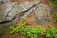
Geological structures took positions around or on top of the Shield millions of years after it was formed. Most Shield rocks were formed well over a billion years earlier, during the period of which the Earth began, otherwise known as the Precambrian era. This being said, Precambrian granite bedrock of the latter is commonly exposed here.
This makes logical sense, taking into consideration that there is sufficient proof in the Boreal Shield that there may have been a soaring mountain range - bearing in mind its geological past and all that is left now is rolling hills.
Additionally, best science shows the foundation of majority of the ecozone is now metamorphic gneiss, a highly banded rock created by intense pressure and heat.
It is also noteworthy to mention that glaciation occurred in the region. During the last ice age which ended 10 000 years ago (relatively recent compared to normal geological time), glaciers swept over this area many times, forcing marks in the bedrock and transporting large boulders many kilometers. Therefore, the resulting series of glacial depressions and deposits, including gravel, sand, shale, and numerous sediments, have given rise to the millions of lakes and wetlands in the region – which give this ecozone its distinguished character.
Climate.
The climate of the Boreal Shield is normally continental with long cold winters and short warm summers. Cold air masses over Hudson Bay bring moderately high levels of precipitation to much of the area, from 400 mm in the west to 1,000 mm in the east. The average midwinter temperature is approximately -15°C, meanwhile the temperature hovers at approximately 17°C towards the midsummer. The average year sees between 60 and 100 frost-free days. Regions neighbouring the Great Lakes and the Atlantic have a tendency to be warmer in winter and cooler in summer, mainly because of its position in the Atlantic.
Climate Analysis.

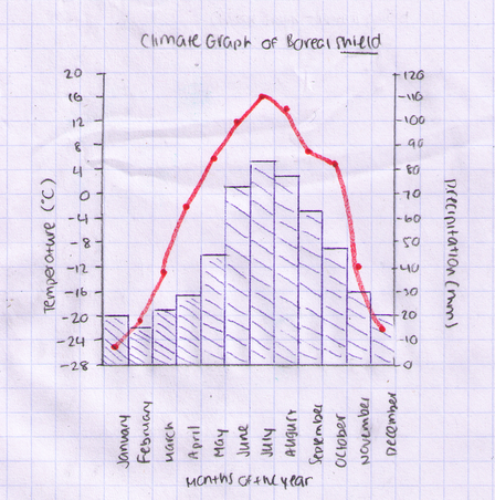
Average Temperature: The average temperature of the Boreal Shield is -2.9 degrees Celsius (approximately -3 degrees Celsius.
Month of Highest Temperature: The month of the highest temperature is July with a temperature of 16 degrees Celsius.
Month of Lowest Temperature: The month of the lowest temperature is January, with a temperature of -25 degrees Celsius.
Month of Highest Precipitation: The month of the highest precipitation is July, with an average measurement of 84 mm.
Month of Lowest Precipitation: The month of the lowest precipitation is February, with an average measurement of 14 mm.
Total annual precipitation: The is 523 mm of precipitation per year.
Water!
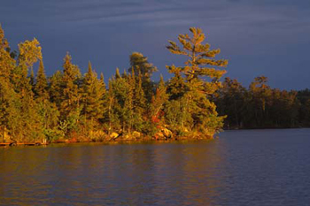
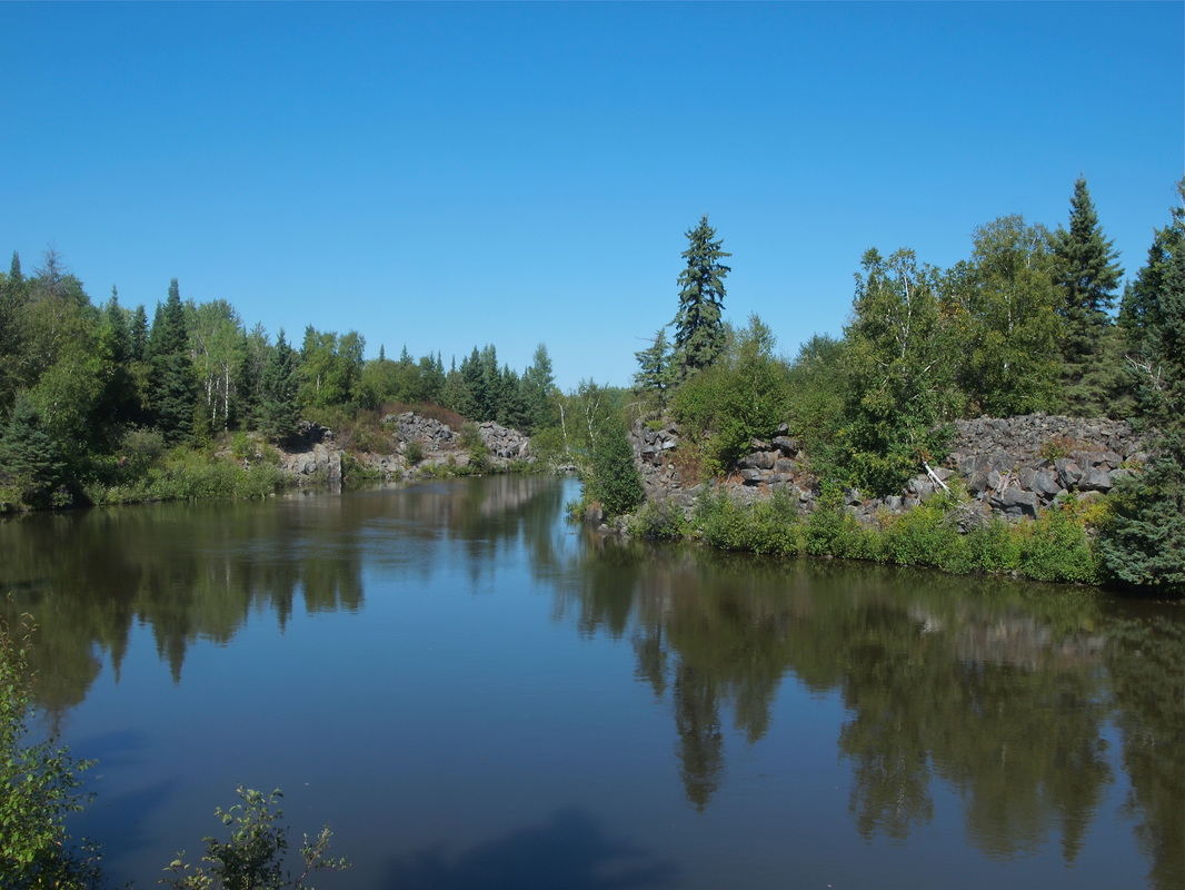
Some of Canada's largest rivers have their headwaters in the Boreal Shield, including the Nelson, Churchill, Rupert, and the well known St. Lawrence. Enormous bodies of freshwater, including lakes Winnipeg, Superior, and Huron, lie among its borders. Within the shield are countless other lakes, some big, such as Like Nipigon and Lac St. Jean, others so small they remain unknown and nameless, even to present day.
Soils.
The soil type in the boreal shield is heavily leached soils like bare rock and very swampy areas. The most common type of soil in the Boreal Shield is leached soil. The reason for this occurrence is because of the amount of precipitation received in the above mentioned region, and generally because of the wet climate. The air masses carry moisture from the bodies of water and are absorbed into the soil. Since the coniferous trees are never bare, fewer needles are decomposed, providing a very thin layer of soil above the bedrock. Moisture is an essential part of the growth of vegetation, however; the leached soils carry away the nutrients which are also vital.
Natural Vegetation.

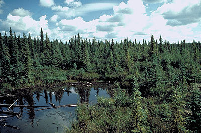
The correspondent to natural vegetation region of the Boreal Shield is the Boreal and Taiga forest. Taking into consideration that natural vegetation is generally influenced by climate (bodies of water, latitude, ocean currents, wind, elevation and landforms) and soil, this means that natural vegetation depends on all of the above mentioned factors. Applying this concept to this scenario, we know that the Boreal Shield is generally cold and dry. This climate does not sustain a large extent of vegetation, for example: cold and dry climate cannot sustain deciduous trees. Therefore, the above mentioned ecozone consists of mostly coniferous trees, since coniferous trees are the only type of trees able to survive such cold climate. Although this is true, there is more than just one branch of coniferous trees, which means that there are numerous types of coniferous trees in the Boreal Shield. This being said, there are characteristics and features that separate one coniferous tree from another. This can be demonstrated by various types of coniferous trees. A specific type of coniferous tree is referred to by its name. For example, the balsam fir, white spruce, black spruce, and tamarack are coniferous trees found in the Boreal Shield, but they are not just referred to as coniferous trees. They have names, and they only reason for this is because they are different in the sense that they have different characteristics about them when compared to another tree of the same category (coniferous).
Additionally, since the soil in the region is acidic, mostly coniferous trees can survive the acidic circumstance.
It is also noteworthy to mention that deciduous trees that grow in this region, primarily in the warmer South, include white birch, trembling aspen, and balsam poplar. Due to the fact that the Boreal Shield is so diverse, lichens and shrubs grow in areas of exposed bedrock. Roughly about 85% of this region is covered by forests, although the climate is cold and dry.
Moreover, there is an average of 60-100 frost-free days a year in this ecozone. 100 days per year are required in order for grain and other crops to grow, (in decent weather conditions of course). However, since weather varies every day and a guaranteed 100 days with suitable temperatures is not absolutely certain, this is the main reason why there are not very many farms in this region.
Rock Types.
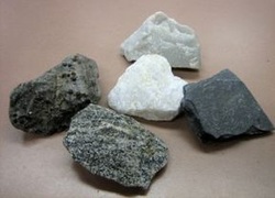
The Boreal Shield has two different types of rocks, igneous and metamorphic. For thousands or millions of years, magma slowly burst traveled up the cracks of the earth's crust and gradually cooled into igneous rock, and with the heat and pressure of even more magma, forms metamorphic rock. The Boreal Shield is a very useful source of lead, gold, nickel, copper, zinc, etc. making it one of the targeted spots for mining.
Wildlife
Taking into consideration that the Boreal Shield is a very large ecozone, the biggest in Canada to be specific, it would only make logical sense for it to consist of a large variety of different animals. These animals range from amphibians to reptiles to bird and so on.
Some of the characteristic large herbivores of the region include woodland caribou, white-tailed deer, and moose. The larger carnivores in the Boreal Shield are the black bear, lynx, bobcat, and wolf. Some of the small herbivores include raccoon, striped skunk and the beaver. They are in turn preyed upon such smaller carnivores as the short-tailed weasel, fisher, and red fox.
Aquatic mammals found off of the eastern coast of the ecozone include grey seal, harp seal, hooded seal, and sperm whale, as well as many others.
Birds of prey in this ecozone include the boreal owl, great horned owl, hawk owl, bald eagle, and red-tailed hawk, as well as a lot more birds. The yellow rumped warbler, blue jay and evening grosbeak, are just a few of the songbirds found here. T
Many species of reptiles and amphibians live in the Boreal Shield. Some of the frogs and toads include the spring peeper, wood frog, and mink frog. The common snapping turtle and painted turtle are two of the turtle species that live in the ecozone. Two types of garter snake, the maritime garter snake and common gartern snake, as well as the redbelly snake, make their home here.
Predatory fish in the ecozone include the lake sturgeon, brook trout, lake trout, northern pike, muskellunge, largemouth bass, sauger, and walleye.
Insects are common in the Boreal Shield; some of the species include the German cockroach, red turpentine beetle, boreal spittlebug, spring azure, American copper, monarch butterfly.
Human Usages.
Since the days the first humans journeyed into the ecozone near the end of the last ice age, the Boreal Shield’s sweeping network of rivers and lakes has served as a crucial transportation route, a foundation for rich domestic fisheries, and a natural wellspring of fur-bearing mammals. More recently these waters have come to be known for outdoor recreation and the development of hydro-electric power.
Despite the fact that much of the freshwater resources of the Boreal Shield are relatively untouched by human activity, others have been widely exploited. Acidification from mine tailings and smelter emissions, Flow alteration and mercury contamination from hydro dams and associated river diversions, and sedimentation and stream disruptions from extensive logging activities are the consequences of industrial development.
Due to the widespread of fire suppression, clear-cutting and single species tree farming as well as insect control, the diversity of both plant and animals is being reduced and forest’s vulnerability to disease is increased over the long term in the boreal forest.
Acid rain from local sources and from the long-range transport of airborne pollutants may be weakening the general vigour and growth rate of trees, as well as of aquatic species, since many shield lakes and soils are extremely sensitive to changes in pH and has already taken an ominous toll.
Fisheries, forestry, mining and hydro generation are all important contributors to the Canadian economy. The Boreal Shield continues to provide more intangible but priceless gifts -- pure air and water, food and habitat for wildlife, and recreational, aesthetic and spiritual benefits.
Hot what? Hotspots!
Algonquin Park, Ontario.
Algonquin Park is located about 2 hours north of Ottawa (Canada's capital) and is 7,630 square kilometres of forests, lakes and rivers. It is a four season paradise for outdoors people. Each year over 2 million people pass through the Highway 60 corridor. Popular activites include: hiking, camping, wildlife viewing (moose, deer, wolves, foxes, bear and all other boreal animals), canoeing and fall foliage colours.
Algonquin Park is located about 2 hours north of Ottawa (Canada's capital) and is 7,630 square kilometres of forests, lakes and rivers. It is a four season paradise for outdoors people. Each year over 2 million people pass through the Highway 60 corridor. Popular activites include: hiking, camping, wildlife viewing (moose, deer, wolves, foxes, bear and all other boreal animals), canoeing and fall foliage colours.
Killarney Provincial Park, Ontario.
Considered one of Ontario Parks’ crown jewels, this majestic, mountainous wilderness of sapphire lakes and jack pine ridges so captivated artists – including The Group of Seven’s A.Y. Jackson – that they persuaded the Ontario government to make it a park. Once higher than the Rocky Mountains, La Cloche’s white quartzite cliffs gleam like snowy peaks from afar. Where paddlers, hikers, skiers and snowshoers now journey through in this craggy, imposing landscape, there is evidence that others passed thousands of years before. Each year about numerous people visit this park.
Considered one of Ontario Parks’ crown jewels, this majestic, mountainous wilderness of sapphire lakes and jack pine ridges so captivated artists – including The Group of Seven’s A.Y. Jackson – that they persuaded the Ontario government to make it a park. Once higher than the Rocky Mountains, La Cloche’s white quartzite cliffs gleam like snowy peaks from afar. Where paddlers, hikers, skiers and snowshoers now journey through in this craggy, imposing landscape, there is evidence that others passed thousands of years before. Each year about numerous people visit this park.
Georgian Bay Coastline, Ontario.
This was voted as one of the most beautiful scenic drives in North America. Passing beside the rugged Georgian Bay shoreline over the granitic Canadian Shiled and through the southern boreal shield this area boasts sparking blue waters contrasts against orange/pink granitic outcrops offering spectacular scenery. It is also home to the only venemous snake in Ontario (the Massassagua rattlesnake). Numerous people do this trip per year.
This was voted as one of the most beautiful scenic drives in North America. Passing beside the rugged Georgian Bay shoreline over the granitic Canadian Shiled and through the southern boreal shield this area boasts sparking blue waters contrasts against orange/pink granitic outcrops offering spectacular scenery. It is also home to the only venemous snake in Ontario (the Massassagua rattlesnake). Numerous people do this trip per year.
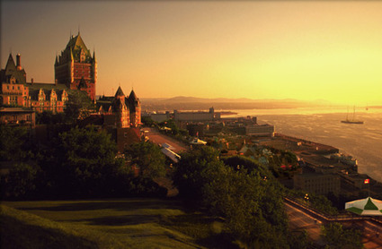
National Parks?
The Laurentian Highlands of Quebec characterize the upland
landscape of the Boreal Shield. Here can be found La Mauricie National Park, on
a gently rolling plateau not more than 500 metres above sea level, and enclosed
with dense forests and sparkling lakes and waterways. In addition to La
Mauricie and Gros Morne, the Boreal Shield consist of several other National Parks:
Pukaskwa and Georgian Bay Islands, located in Ontario; and Terra Nova, located
in Newfoundland.
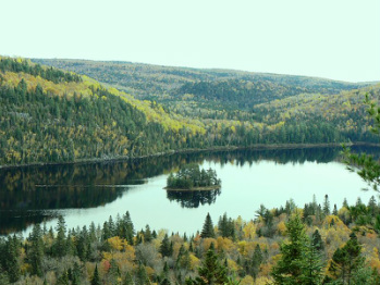
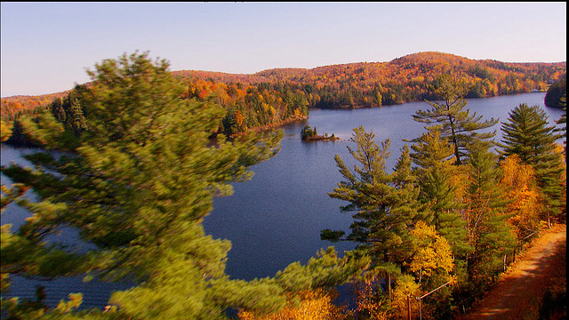
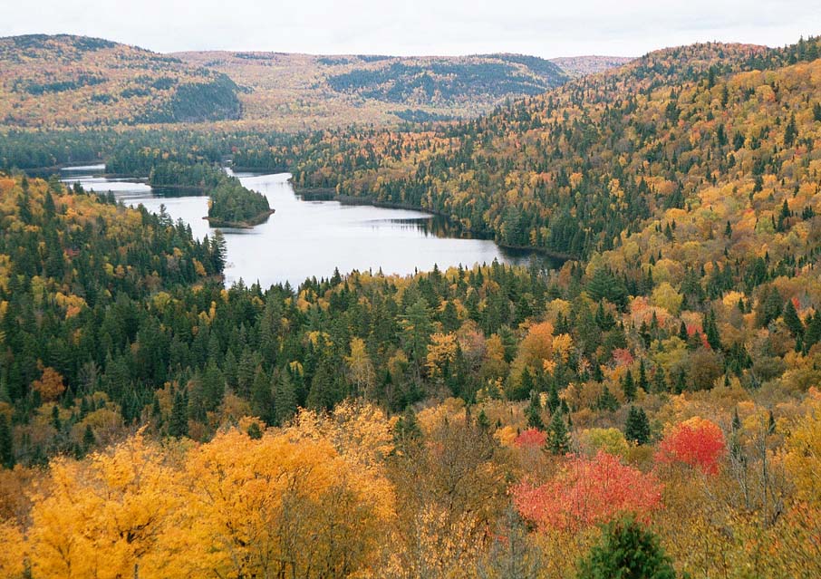
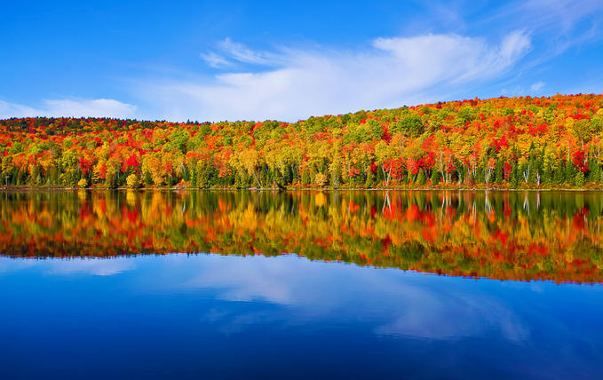
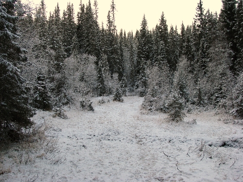
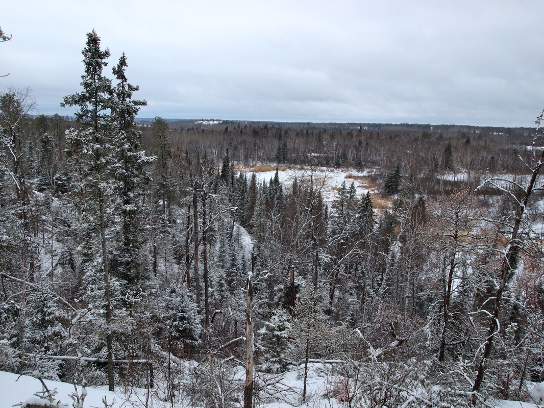
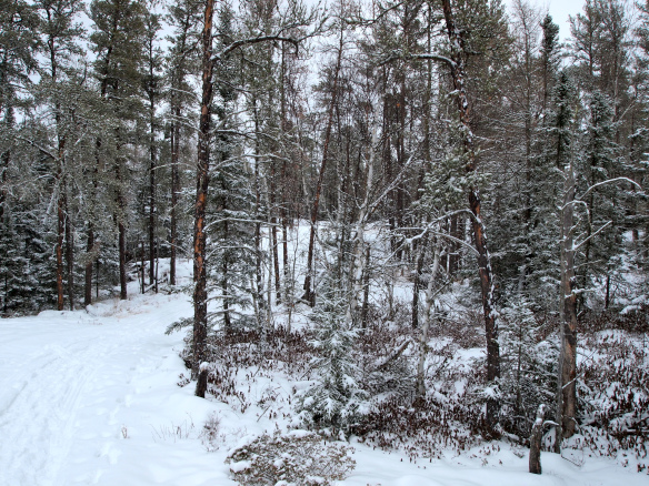
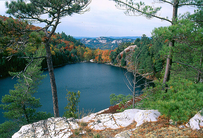
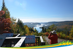
The image to the right illustrates La Mauricie National Park in Quebec.
La Mauricie National Park is a 536 squared kilometers natural conservation area envisioned as a representative sample of the southern part of the Canadian Shield. The park’s lakes and forests make it a flawless place to serenade in numerous outdoor activities. For more than 40 years, La Mauricie National Park has been offering memorable recreational and educational experiences to visitors from around the world, allowing them to discover Canada’s natural and cultural heritage treasures.
La Mauricie National Park is part of the network of parks and historic sites administered by Parks Canada, which in 2011 celebrated its 100th anniversary as the first official national park system in the world.
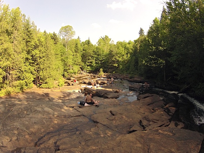
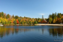
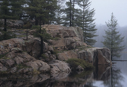
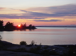
The following images overlook La Mauricie National Park.
The image to the right illustrates La Mauricie National Park in Quebec.
La Mauricie National Park is a 536 squared kilometers natural conservation area envisioned as a representative sample of the southern part of the Canadian Shield. The park’s lakes and forests make it a flawless place to serenade in numerous outdoor activities. For more than 40 years, La Mauricie National Park has been offering memorable recreational and educational experiences to visitors from around the world, allowing them to discover Canada’s natural and cultural heritage treasures.
La Mauricie National Park is part of the network of parks and historic sites administered by Parks Canada, which in 2011 celebrated its 100th anniversary as the first official national park system in the world.
The following images overlook La Mauricie National Park.